6° leg: Ceselli – Spoleto
6° leg: Ceselli – Spoleto
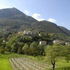
From the intersection with the SS 209 Valnerina highway, you will ascend along the Valle di Pontuglia tucked between mountain slopes. Walk with the stream to your left, first taking Via Contaglia and then keeping left on Via Pontuglia. After the mill and near the village of Pontuglia (km 1.9), turn left and pass the stream. Begin the long, progressive climb that will lead you to the Castelmonte saddle in about 6 kilometers. The route begins on asphalt; pace yourself, walking slowly and conserving your energy. At the solitary country cemetary (km 3.7), turn right on an uphill rocky road (slippery when wet; use hiking poles). Following the signage, continue climbing. After passing a shallow stream, take a look behind you to enjoy the wide view over the valley, Monte Civitella, and the dramatic bare rock face opposite. The trail continues into the thick woods, alternating between short climbs and level stretches. Cross the shallow stream and, after a steep climb, enter the piazza of the abandoned village of Sensati (km 6.8), where you can stop and rest.
Climb toward the right, passing the village’s main street. The signage is easy to follow, but the marked trail narrows (use caution) and curves first to the right and then to the left. In less than 1 kilometer you will reach the tough Valico di Castelmonte saddle, 933 MAMSL (km 8), which marks the border between the Valle Spoletana plain and the mountainous Valnerina. After a few steep, wooded stretches (km 10.4), you will come out onto an asphalt road. Here you can decide to stop for the night at the hamlet of Patrico, about 700 meters along the road to the left. The route, instead, crosses this asphalt road and continues straight along the trail which skirts a metal fence. Near a hamlet, you will pass an old water fountain. After a short stretch along asphalt, turn left onto a mule track. At the picnic and barbeque area (km 13), follow the asphalt and then turn right into a pine grove. Follow the signage for Monteluco at the fork. You will be back on an asphalt road which runs along a number of art nouveau-style houses; you are nearing the Convento di San Francesco and the Bosco Sacro di Monteluco (km 14.3). This is a moving and compelling place, inspiring modern visitors to pause in contemplation just like the ancient Syrian hermits who first settled in these grottoes. Keep climbing left to the lot, from which you will descend to Spoleto beneath the shade of ancient beech and holm oak trees. The route downhill—at times steep–is lined with a number of pretty shrines and hermitages: the Eremo di San Girolamo, the Eremo delle Grazie, and the church of San Paolo Protoeremita. Between the trees, you will catch glimpses of the Rocca Albornoziana fortress and the town of Spoleto stretching out below. In less than 2 kilometers you will reach the Ponte delle Torri (km 16), which bridges the gulley between the town and its wood and is exhilarating to cross. Once you reach the bottom of the fortress, ignore the signage directing you to continue left, instead turning right to enjoy the magnificent view over the valley and the next legs of the route. After circling the fortress, descend along Via Aurelio Saffi as the narrow road suddenly and surprisingly opens onto the wide piazza, dominated by the facade of the Cattedrale di Spoleto (km 17).